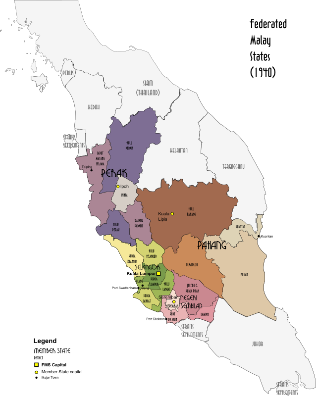
Map of the Federated Malay States, 1940
by derkommander0916 - uploaded on May 24, 2015, 7:18 pm
A map of the British Protectorate of the Federated Malay States in 1940, now part of Malaysia. Done in the style of http://commons.wikimedia.org/wiki/User:XrysD
Log into OpenClipart
- Tags
- 1930s 1940 british colony empire federated malay states fms history malaya malaysia map protectorate ww2
- Safe for Work?
- Yes
0 Comments. Please login to comment or add your own remix.