Palestine UN 1945 1947 borders with flag
by nerdy - uploaded on March 31, 2026, 12:15 am
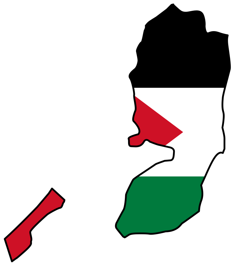
Map of Palestine showing Gaxa strip and West Bank using 1945/1947 UN borders, with Palestine flag overlaid, from https://commons.wikimedia.org/wiki/File:Flag_map_of_the_Palestinian_territories.svg Also see Gaza Palestine flag map https://openclipart.org/detail/355192/gaza-strip-map-and-palestine-flag which is not a deviation. Current Palestine territories are smaller because Israel's illegal land grab, although all Palestine is under occupation by Israel, which even controls the borders at sea and with Palestine's neighbors Egypt, Lebanon and Jordan.
Log into OpenClipart
- Tags
- Palestinian+territories Palestine map flag+map Palestine+flag Palestinian territories black+white+green+red two-state+solution occupied anti-settler occupied+territories Gaza West+Bank West Bank UN United+Nations anti-war remix+355197 West Bank remix+13076 Gaza+strip Gaza strip anti-settler anti-war liberation occupation territories flag free free+Palestine 1947 1945 pro-Palestinian human+rights self-determination free freedom West+Bank rights borders land nation Middle+East conflict two-state+solution war+crimes peace solidarity country source+external
- Filesize
- 4 k
- Safe for Work?
- Yes
This clipart is a remix from:
West Bank UN Palestine flag map
by @nerdy
Flag of Palestine
by @Anonymous